 |
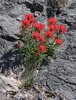 |
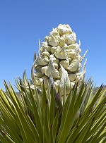
| Yuccas (Joshua Tree) and some red desert flowers are abloom again |
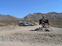 |
| Two wagons at Teakettle Junction |
An off-road trip near Death Valley had been planned long ago, grandmother willing to baby-sit had arrived, only in the last moment,
Sid came with the idea of an entrenching shovel. My virtual and non-virtual friends immediately responded with various comments
regarding the combination husband-desert-shovel, but I had to admit that my Hippo was right in some ways. Should we ever
get stuck somewhere with our wagon, the kind of rocky terrain around here does not allow for just any civilian junk shovel.
And so I found myself driving like a fool around all four corners of a very busy intersection of two six-lane streets in Santa Clara,
to discover that the
surplus store was not hiding on any one of them. My Hippo had subsequently admitted that he actually
was not quite sure whether the establishment in question was located exactly at this intersection, or perhaps a block or two
(it was four) down which ever way. I knew Gabina got the same task from Radim, and bought two entrenching shovels.
On Friday morning, hour H minus 12, Hippo's eyes lit up - when tracing our planned route on Google Earth,
he had found aerial pictures of something that looked like a major landslide across the road - finally some
really good potential for disaster!!! My logical arguments in the sense that data on Google are likely to be older
than a year and the road might have been re-bulldozed, would not diminish his joyful anxiety. He may have really
looked forward to trying out the aforementioned shovel. Eventually he left for work and I took the kids, granny, Jana,
and the twins on a trip to Felton.
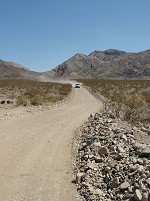 |
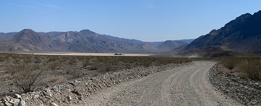
| A perfectly bulldozed dirt road led even through Lost Burro Gap this year. |
 |
| Tens of adventurous tourists arrive daily over a dirt road to this natural wonder. |
Kubackis with Lukas came in the evening, followed by my Hippo, who began entertaining our visitors with his
dark visions of our track. Eventually I managed to interrupt this session, send Hippo off to pack, load the car,
and then we waved goodbye to our kids and granny (who not only agreed to take care of our juniors, but added
little Lukas), and began to chop off first four hours of our journey to Death Valley. By half past midnight
we fell in our beds in Tehachapi. A serious breakfast opened our morning -- our last civilized meal for the
next two days -- we handed our friends a walkie-talkie, discussed last detail of our route, and agreed on meeting
in Olancha - the last place with a gas station.
From there, it took only a short distance over paved road, and we were turning off to
Hunter Mountain.
Three jeeps passed us at the intersection, but soon they stopped by the side, with their crews admiring a yucca grove.
Hippo and I pushed on, for we had taken pictures of this particular valley years ago already. Cows were roaming
in the canyon, so our driving style gained a noticeable rural twist. Pausing on a hill, we snapped a few photos
devoid of tourists, and waited for the rest of the expedition. A crossroads awaited us a few miles farther --
Hippo turned right without hesitation, but then lost his resolve and looked for the GPS to confirm the route.
Here it became obvious that "someone" had forgotten the GPS at home (you may guess who, between the
two of us, packs our computers and other gear). He had soon produced a spare receiver that we carry in our wagon's
door pocket, but this one cannot be connected to a notepad, and we were forced to copy down LAT/LON numbers
and pan through an onscreen map. The delay was not entirely wasteful though -- for I forced my way behind
the wheel.
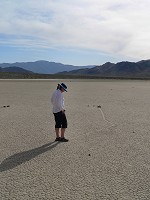 |
| Carol (may be) contemplating secrets of the racing rocks. |
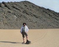 |
| This very racer had sunk in and has not competed for at least two years. |
Reaching a ridge summit, it became quite clear we chose the right way -- we remember Hunter Mountain quite well. Five years
ago, it was partially covered with snow and we were occasionally plowing through drifts, expecting a disaster every moment
(like a deep frosted puddle hidden under snow). This year the road looked like freshly bulldozed, and only symbolic traces
of snow could be sparsely spotted in ditches. The only surprise materialized in the form of a huge boulder in one of the
harder turns -- but we were expecting it as it had been noted on a board near the beginning of the road, and it was rather
easy to avoid.
This time we did not get confused and, being experienced off-roaders, we avoided Quackenbush.
Hidden Valley had surprised
us (again) not only how beautiful it is, but with a smooth, well groomed road. There were no nasty ripples -- only coarse
gravel, on which our wagon floated comfortably. By
Lost Burro Gap I was already almost complaining about the nice road,
wishing to drive on something more interesting. I should have known better at my age that one ought to be very careful with
wishes, for one may get them granted, but I somehow did not recall this wisdom at the moment.
We roamed around
Racetrack a bit, visiting the Grand Stand and the racing rocks. It seemed that it had not rained
since the previous year -- rocks had not moved and ugly, human-trodden places stood out on the playa. Still we managed
to take a few photographs, but then the descending sun chased us onward. We had a route to Saline Valley ahead of us, which
we did not take before, and which possibly contained Sid's landslide. We rushed past a sign recommending four wheel drives
and high clearance undercarriage, and drove quickly down into the canyon.
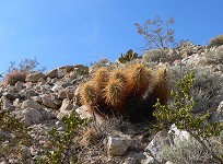 |
| A parched wasteland attracts a careful eye with its abundance of colors. |
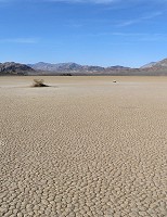 |
| A courageous bush breaks through the sun-baked mud tiles.
It may not rain for several years here. |
Sid usurped the wheel again and as we worked down along Ubehebe Road into
Lippincott Canyon,
I was happier and happier that he did. The unmaintained road beset with large rocks turned in places into chaotic staircase
made of irregular, huge boulders. Even our first gear was too speedy -- we were sliding down this path on brakes, letting the front wheels
slip over the large step, stopping, then allowing a slow move forward and hoping the back axle would follow without an accident.
In several spots I had the feeling that we would lose not only the rear view mirror and some paint off our side, but perhaps
some doors as well? Only hope remained that the road was going to be passable (or perhaps slideable) all the way to the end
-- we would not be able to drive back up the hill (not with these cars that have no low ratio gear), even if we were to succeed
in turning around on such a slope.
Then, finally, a view
Saline Valley opened in front of us. And I exhaled. Too soon -- our rocky road became relatively horizontal again,
but it was being crossed by countless, unbelievably rough, dry creek beds. We would move forward in strange jumps - rattling over rocks,
slowing down, slipping into the arroyo, crawling out of it, rattling over rocks and so on and on until we reached Saline Valley Road
on the other side of the valley. Gabina declared there that she would want to have a jeep for this trip, not a Subaru. Sid replied that
any dumpling could pass it in a jeep, but I'm not so sure how much is had dispersed her doubts.
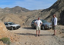 |
| Before attempting the hardest part of our descent, we bid farewell to our friends, just to make sure. |
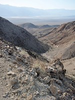 |
| A view from Lippincott mine into the canyon of the same name, descending into Saline Valley. |
I took over the wheel again in Saline Road -- Sid declared that he got totally "driven through". I merrily began to accelerate on
this occasionally maintained road -- and very soon timidly backed down to third and second gears -- for we would still have to cope with
arroyos that were very hard to see in an oblique, evening sun. After twenty miles I had the feeling that my eyes would pop out of my head
-- I dared to hope the sandy turn-off to the springs would be somewhat better. Well, it's true that while driving on sand one does not
need to worry so much about the fate of the differential or exhaust -- but right after first few yards I had succeeded in jumping with the
wagon with such a force that Sid got smacked good by a side column.
For the remaining six miles we were spawning theories about the local hot springs and whether there'd be any people. The answer to the latter
question came apparent soon -- a huge motor home stood proudly under some palm trees on the horizon -- and soon it became clear that there
was a whole herd of them. It was easy to find the spring -- surrounded by a manicured lawn that would make many golf ranges proud, contained
in a concrete tub, and containing three sophisticated looking, bathing suit wearing, induhviduals. All this in the intimate vicinity of
aforementioned motor homes and an outhouse. Sid announced that more springs were being mentioned on a board, and we moved on.
Palm Spring looked friendlier. It was still nicely paved and concrete-cast, but was momentarily being abandoned by five rather
cheerful and very naked geezers. We concluded that this was the right address for us, and quickly jumped in the pool. Unfortunately, it only
took moments before we gained more company, hence we had no chance to take pictures. After all we did not feel that other friendly nudists
would appreciate a presence of a camera there.
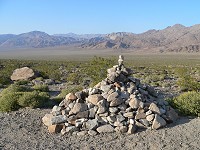 |
| Spring desert in Saline Valley is forcefully green. |
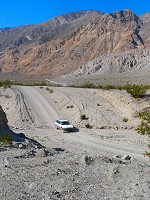 |
| Gabina is crossing an arroyo, playing bulldozer. |
Before we got seriously warmed up and relaxed after a hard day, darkness came. We drove on to the nearest empty spot, parked
our wagons and unpacked dinner. A nightly sky full of us shone very brightly; here in the desert, where there's no other light noise
one can see so many start that it is difficult to spot familiar constellations. This time I would not enjoy the silence of the desert
-- shortly put, a campground has always people who make some din; a motorbiking party sang and bongoed until early morning, our
eastern neighbors tried to smoke us out with their always fading fireplace -- for me, this was way too much civilization.
And Sid slept well, as soon as he dropped on his mat, and he did so very loudly, until I began to contemplate alternative uses
of our entrenching shovel.
Morning sunshine creeping in through our windows and into our sleeping bags, pulled us out. We treaded carefully around our wagon,
but it turned out that Gabka and Radim had long gone back to the spring and were soaking. They said they got up before sunrise
and watched it sitting in our camping chairs, which had explained my little mystery - I was sure that we had left the chairs next
to our car, and in the morning we found them several yards yonder, and in my mind I blamed in order, Sid, a wind, and UFOs.
We wolfed down our breakfast and rushed on. In daylight, the road across the dunes did not look as bad as it did
at dusk. We joined Saline Valley Road in the spot we left the previous night -- the route is apparently more
frequented in the northern direction. It quickly became a regular dirt road, allowing the use of fourth gear.
Eventually we would climb into mountains -- I had to slow down, but the road remained nice and untreacherous.
With six and half thousand feet we met with snow again -- surprisingly white and clean remnants, huddling on
northern slopes of Waucoba Mountain. The road took us to the highest point of 7,223 feet - and then only down
- in a scenery which reminds much of the eastern Sierra Nevada. Soon we glimpsed the very one Sierra -- and
it became clear that our journey was near its end. Having brushed off our cars of dust accumulated on hundred
fifty miles of dirt, we found ourselves on a smooth, civilized pavement again.
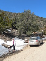 |
| Snow would lay around above six and half thousand feet. |
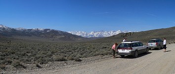 |
| End of the journey. Brushing off dust, with Sierra Nevada in background. |
We had a team lunch in Big Pine, and disbanded the expedition. We had no further need to stick together on regular roads,
while we still had to drive four hundred miles. Perhaps I should mention
Robin Hood on highway forty six.
He was driving in front of us in his dark blue golf, apparently equipped with a radar detector, for he was aware of every
policeman on the route, and he would not forget to point out every "sensitive" location by demonstrative slowing down,
sometimes even gestures above his car's roof. Hwy 46 is a regular road connecting hwy 99 with 5 and subsequently one oh one.
Speed is limited to fifty five mph there, and the cops had a field day and were swarming in a excessive numbers.
We had reached Paso Robles with no incident, pumped some gas, and sped towards home. Our paranoid ideas about arriving close to midnight
would not come true -- there were no traffic jams that would delay us; we even caught our kids up, at least fifteen minutes before their
bed time. Is seemed that little Lukas had comfortably spent the whole weekend in the care of our granny, our own kids, too, did not
look disturbed, and even grandmother would seem quite okay. Both wagons fared well, and Gabina with Radim may eventually forgive us
Lippincott Canyon.


